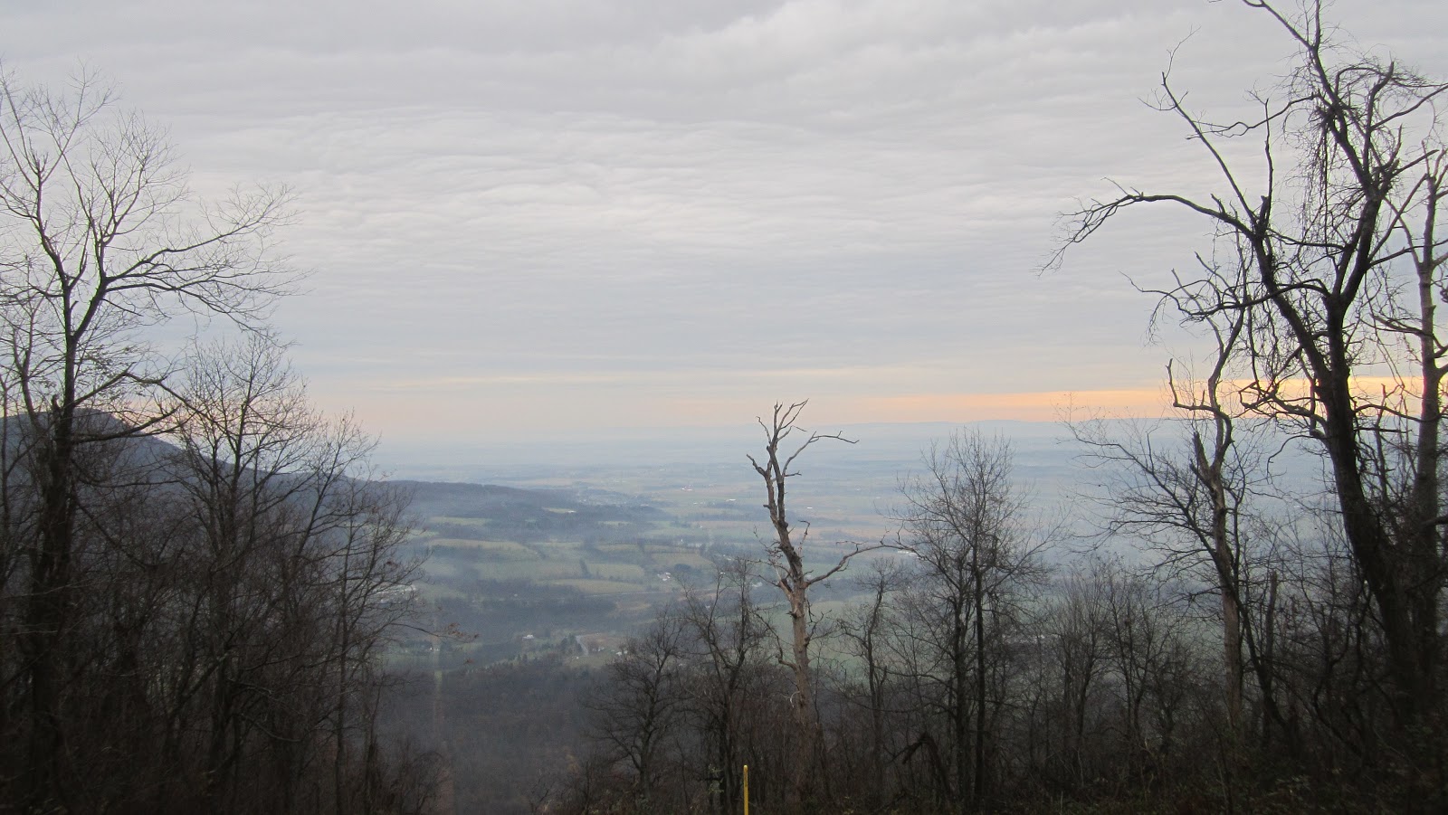
Wednesday, September 18, 2013

Zion National Park

A trip to Las Vegas gave me a chance to backpack somewhere different that the usual Appalachian mountains of the east. I decided to go do a few days of hiking in Zion National Park. Only two and a half hours from Las Vegas, the main feature of Zion is the spectacular canyon carved by the Virgin River.

I arrived in Zion late in the day and spent the first night at the Watchman campground, one of the two large campgrounds in the park. My plan for the next day was to hike up the West Rim Trail to the backcountry campsite I reserved, then set up camp and do a day hike up on the West Rim. I did a quick hike on the Watchman Trail that goes to an overlook of the campground and visitor center area and went to bed early. A strong wind was blowing all night making it hard to sleep and cook breakfast in the morning. After eating I parked my car at the visitor and got on the shuttle bus to the trailhead. To keep things under control during the summer you have to take a shuttle bus into the actual canyon. I arrived at the trailhead at about 9 AM after a brief stop for a breakfast sandwich at Zion Lodge. I now had a 3000 foot climb to get to the west rim of Zion Canyon. Fortunately the sky was overcast making it easier to stay cool while climbing. The trail followed the Virgin River a short while before climbing on switchbacks on a trail blasted out of the side of the canyon wall. There were a ton of hikers as this led to Angel's Landing, one of the most popular places in the park. The trail itself looked like it was paved and you could have gotten a wheel chair up it.
View on the initial ascent of the West Rim Trail
The trail followed the canyon wall to a small canyon that led away from Zion Canyon. A short period of level walking led to another series of short switchbacks up to the base of Angels landing. From here one can climb Angel's landing but I continued the other direction up the West Rim Trail. From here the paved trail ended. Initially the trail followed a rim above the main Zion canyon with views down to the road.
View of Zion canyon from the trail beyond Angels landing
The trail continued away from Zion canyon at this point through a small valley before steadily climbing up another canyon. Eventually the trail went up another series of switchbacks carved out of the side of a cliff to reach the top of the plateau. My campsite was right at the point when the trail reaches the top. I set up my tent and relaxed for a while. The view from the campsite was amazing. On the top of the plateau the West Rim trail makes a 5 mile loop. With a much lighter pack now I decided to dayhike the loop. One suprising thing was how green parts of the plateau were. Several thousand feet below was dessert but there were places up here that were surprising green.
The plateau was surprisingly green
Eventually I came to the end of the loop where the West Rim trail either looped back towards my campsite or continued on to Lava Point. I headed back to camp. The best views of the day were on this section. To my right I think I could see all the way to the Pine Valley Mountains west of St. George.
Pine Valley Mountains in the distance
View of the valley I passed through on my way up to the west rim
Several miles later I arrived back at camp. I spent the rest of the day relaxing and reading. At one point a deer and faun decided to snack on some bushes near my tent. They must have been used to people because the let me get very close to them. At one point I checked out the "spring" near my camp and needless to say  I was glad I brought enough water with me for the hike. I went to bed before sunset and slept better because there was little wind.

I had to be back in Las Vegas by noon so I woke up before the sun was up. I packed up and started the 5 mile downhill walk back to the trailhead.
Sunrise at I head back down the trail

The sunlight on the red canyon walls was gorgeous
Two hours later I was down at the bottom. I learned when I got to the bottom that somebody had fallen at Angels Landing the previous day and was going to be helicoptered out. All in all it was a great hike and a nice change of scenery from the eastern woodlands I usually hike in.

Sunday, June 2, 2013

Dolly Sods and Roaring Plains

With Memorial Day coming up again and the weekend free I of course wanted to backpack. Last memorial day had been my first trip to Dolly Sods in West Virginia and I had been wanting to return since then. I also had been reading about the Roaring Plains, the area just south of Dolly Sods Wilderness known for some outstanding views. With three days I realized I could see both.

To those who are unfamiliar Dolly Sods is a Wilderness area in the northern part of the Monangahela National Forest of West Viriginia. Dolly Sods itself consists of two distinct areas. The northern section of is a plateau at about 4000 feet known for the open views and meadows unlike anything else in the Mid-Atlantic. The opens meadows are a result of the forest being logged and then fires that have prevented the forests from growing back. The southern part of Dolly Sods contains a canyon carved by Red Creek the headwaters of which start up on the plateau. There is an extensive trail system in the area. The southern border of Dolly Sods is marked by a forest road 19 and on the other side is an area known as the Roaring Plains. It consists of an even higher, but smaller plateau with maximum elevation of almost 4500 feet. It also is the edge of the Allegheny Front with massive dropoff at the front. There are unofficial trails to the edge of the Allegheny Front rim that feature outstanding views.

I woke up early on Saturday and drove to the Red Creek trailhead at the southern end of Dolly Sods. From here one can follow the Red Creek trail up to the northern section of the Sods. Already it was packed with people so I was forced to drive up the road a mile to a parking lot for the south prong trail, one of the paths that climbs up to the Roaring Plains plateau. I put on my pack and was off down the road back to the Red Creek trailhead. My plan was to take a one of the side trails called the little stonecoal trail. This trail follows a stream up to the western side of the plateau above Red Creek, from there I would hike another trail to the Big Stonecoal trail, and pick up another trail that would take me to Red Creek several mikes upstream from where I crossed it. I hiked up the Red Creek trail for a mile and came to the Little Stonecoal junction from the Creek. A shoes off crossing got me across Red Creek and the start of my climb.
First Crossing of Red Creek
I had about a one and half mile climb up the Little Stonecoal. Here was where I started seeing a lot of down trees, probably left over from hurricane Sandy. For the most part they were fairly easy to pass and I made it to the top. Since this is a wilderness area the trails are not blazed and at one point close to the top I found myself off the trail. After a short while looking at the gps I figured out my mistake and found the end of the Little Stonecoal trail and the beginning of the Dunenbarger trail. This trail follows the plateau and takes you to the Big Stonecoal trail which runs between Red Creek and the western edge of the wilderness boundary. Shortly onto the dunkenbarger trail I realized this was going to be slow going. Last Labor day I had hiked this same trail in about 40 minutes. Now I had the blowdowns from Sandy to contend with. The forest here was thick rhododendron and red spruce. It seems like every 100 feet I would come to another downed spruce tree with limbs pointing all over. The forest made bushwacking around a chore sometimes and once I had trouble finding the trail. Halfway thru you pass by the namesake creek and a nice campsite.
Dunkenbarger creek
For some reason this always reminds me of Minnesota or somewhere further north, this is one of the charms of the area. Eventually I made it to the Big Stonecoal trail but it probably took twice as long as last year. A short ways down the Big Stonecoal you pass the Rocky Point trail which I took. This intersections the Red Creek trail a mile up. Along you way you pass a side trail to large rock outcropping known as the Lion's Head. I took the trail up and ran into some fellow Buckeyes. There were great views of Red Creek from the top.
View of Red Creek Canyon from the Lion's Head
After taking pictures I continued on my way to the Red Creek trail. Picking up the Red Creek trail I headed back down to Red Creek. Half way down I realized my map was no longer in my pocket and I had to hike back up about 5 minutes to find it. Eventually I made it down to Red Creek and had another shoes off crossing. I had originally intended to go further but I was tired and found a nice campsite by the creek. I set up and spend the rest of the day relaxing.

First Night's campsite by Red Creek
I woke the next morning and started the day with a climb. My plan for today was to take a trail called Fisher Springs up to the Rohrbaugh Plains Trail. The Fisher spring trail connects Red Creek to FR 75 which forms the eastern boundary of Dolly Sods. I began my short climb up to the Rohrbaugh plains. Part way up I lost the trail once again due to the lack of blazing. After wasting 15 minutes I found the trail and made it to the Rohrbaugh plains. From here it was about 3.5 miles to FR 19. Along the way I passed another outstanding view looking at Red Creek Canyon. Across from here I could see the Lion's Head where I had been yesterday.
View of Red Creek from the Rohrbaugh Plains trail
The trail was full of blowdowns again. This didn't deter the large number of people I saw on the trail that morning. I made it to FR 19 by noon and stopped for lunch. The Dolly Sods part of my trip was done. Now I would be entering the Roaring Plains. A short walk down the road brought me to one of the trailheads of the South Prong Trail. I was to walk 2 miles down the trail to the start of the unofficial trails that would take me to the canyon rim. Unlike the trails in the Sods the South Prong trail had no blowdowns at all. I attribute it to the fact that it is not a wilderness area in this section. I preceded down the trail and arrived at the area where I needed to start looking for the hidden passage trail. I should take a moment to thank Mike at Mid-Atlantic hikes whose maps and write-up of the roaring plains makes accessing the canyon rim possible (http://midatlantichikes.com/rp2.htm). In any case I found the start of the hidden passage trail. Although it is unofficial, the trail is used enough that it was easy to follow. The trail takes you to the rim the Roaring plains. Along the way I ran into the only hiker I would see in the Roaring Plains. He took me to a secret vista that was spectacular.
Secret vista from the Canyon Rim on Roaring Plains
We said goodbye and I continued on the hidden passage trail. I got slightly confused when I missed a cairn but I eventually made my way to an area know as Seneca Meadows.  This is another large open meadow like in Dolly Sods right on the rim of the plateau. My original plan was to continue on the next segment of the trip, another unofficial trail called the canyon rim trail and camp somewhere along it. This would take me to an official trail, the Roaring Plains Trail that I would use to return to my car the next day. Given the trail conditions I had seen and the fact that the Canyon Rim was not an official trail I was leary of continuing since I needed to be out early the next day. I decided to camp at Seneca meadows and take a day hike further along the canyon rim. I was near a gas line that offered easy access to the trail back to the car the next day. I set up my tent and unloaded my pack. I went off with a must lighter load to explore the canyon rim. From my campsite I walked through the meadows to the gas line.
Senaca Meadows
Down the gas line was the start of the Canyon rim trail. The tread was not as obvious as the Hidden Passage. Despite MR Hyker's notes I made slow time and eventually came to my first vista on the rim.
First View on the Canyon Rim Trail
By this time it was 5 pm and I felt like I should turn around as there was no way I was going to get out to see the highlight vistas down the trail. I headed back to my camp and spent the evening relaxing. The view from my camp was probably the best I have every had.
View from my campsite at Seneca Meadows
I had a relaxing dinner and was in bed before dark.
The final day was uneventful. I returned to the gas line and a 15 walk took me to FR 70. From here I went to the Boar's Nest trail which led down to my car. After a tiring descent (about 1500 feet) I made it to my car by 9 AM.

The views from the Canyon Rim were some of the best I have seen in the Mid Atlantic. I will return to check out more of the canyon rim trail. Also for people seeking solitude I saw about 100 people in Dolly Sods and 1 person in the roaring plains despite the fact that they are right next to each other and the scenery in the Roaring Plains is at least as good as Dolly Sods.

Sunday, May 5, 2013

Susquehannock Trail

This last April I wanted to do a longer backpacking trip around 70 or 80 mile, somewhere in the east. I also wanted a more solitude that could be provided on the Appalachian Trail. Fortunately Pennsylvania has a wealth of lightly used long distance trails. Having hike all or part of many Pennsylvania trails I decided on a PA trail that I had never hiked on before, the Susquehannock trail.
Located on the rugged Allegheny Plateau in north-central Pennsylvania, the susquehannock trail is a 85 mile loop located primarily in Potter County. The trail has an active trail club (http://www.stc-hike.org/) and is fairly well maintained. The trail passes through several state parks as well as the Hammersley Wild Area, the largest roadless area in Pennsylvania. This is the most remote part of Pennsylvania and very lightly populated, meaning plenty of solitude on the trail. Recently the club cleared a couple of cross connectors allowing shorter loops to be made. I decided on a loop using the central cross-connector just cleared last year. The connector connects at approximately miles 74 and 14 of the STS allow a 68 mile loop to be made. I highly recommend getting the trail guide produced by pine creek outfitters. The guide and maps are accurate and the campsite locations indicated proved to be good.

We decided to start from Ole Bull state park and hike the 68 mile southern loop in 5 days.

Day 1

We arrived at Ole Bull State Park, around 10:30 in the morning to a cloudy sky. After signing in at the part office we were on our way. The trail immediately climbs 1000 feet to the top of the mountain overlooking Ole Bull. Fortunately the trail is switchbacked and part way up is one of the few large vistas on the hike where you can see Ole Bull below.

Vista of Ole Bull
In what would be the theme of the hike, after reaching the top we almost immediately descended Impson Hollow reaching some hunting camps and a pine plantation at the bottom. Then we began another climb reaching the top of the plateau again. Next we descended to spook hollow where the trail builders had some fun with the signage.
Spook Hollow itself was a dark pine plantation. After safely getting through spook hollow the trail remained fairly level for the next several miles as we remained on top the plateau. At one point the Donut Hole Trail merges with the Susuquehannock and you will also pass 2 trails that link to the Black Forest trail. After a time we came to the steepest descent of trail down Morgan Hollow. This is one of the steepest trails I have seen in PA and some large blow downs did not make the 700 foot descent any easier. We eventually reached the bottom and crossed a bridge named Ted's Truss. One more climb and descent brought us to Greenlick Run. After having gone 13 miles we decided to call it a day. We found a small campsite near the area indicated on the map and set up camp. One thing to note is that the campsite locations designated on the map are fairly accurate and beyond those there are not many established sites.

Day 2
Overnight it got down to the low twenties so we didn't waste any time in the morning getting moving. The trail continued to follow Greenlick run for another mile or so. There were a few tricky crossings and I ended up with a wet foot. After climbing out of the the hollow with Greenlick run we stopped for breakfast. After that the STS followed a few roads on level ground before coming to a gas line.
The gas line you follow a while
We followed the gas line for a while before veering off into the woods again. After going into the woods we went into a pretty gorge created by Scoval Branch. There was a lot of beaver activity here. We continued in the gorge before another climb to the top of a mountain. The top of the mountain had been clearcut. Next we had a thousand foot descent to the town of Cross Fork. We were both looking forward to this as there is a restaurant in Cross Fork.
The town of Cross Fork

After descending several miles we arrived at the town and hit the restaurant. After talking almost 30 miles the food was heavenly. We had stromboli, halepeno poppers, ice cream, and several beers. After eating we left Cross Fork and had another 1000 foot climb. All the food made the climb rather hard but eventually we reached the top. Once at the top we descended to the Hammersley Fork in the Hammersley Wild Area. This is the largest roadless area in Pennsylvania and the STS does not cross a road for 10 miles. The Hammersley Fork makes a beautiful narrow valley. Along the way are excellent camping spots. In addition there is a famous landmark known as the pool where there is a deep swimming hole.
The Pool

We pressed on another few miles before stopping for the day after another 16 miles.v We were tired as much of the trail along the Hammersley follows sidehill that was in desperate need of repair making for difficult going.  Whoever had been at this site before build one giant fire ring.
Our campsite the 2nd night

Day 3
After another chilly night we had a 16 mile day ahead of us. We packed up and were on the trail early. The STS continued to follow the Hammersley for another couple miles before climbing out of the valley. The climb brought us to another dirt forestry road and we immediately had another descent of a couple miles down Gravel Lick Hollow. This was one of the prettiest stretches of the trail. The hollow was very wide with open forest and hemlocks scattered about. The descent was gradual and the trail was in good shape here.
The view down gravel lick hollow
 Once we got to the bottom the trail followed along side the east branch of Sinamahoning Creek on an old road for over a mile. To the right were scattered houses and farms along East Branch Road, one of the few paved roads we crossed.
The valley created by the east branch of the sinamahoning
We left the road at an old 1980's era TV satellite dish and walked across the valley on a dirt road through a farm. After crossing east fork road we stopped for lunch. We still had 8 more miles go from here. For some reason this next stretch felt like the hardest part and my least favorite stretch of trail. The STS does a roller coaster here with several ascents and descents, some of which are quite steep. Some of he forest here must also have been logged as unlike the large, open forests we had been seeing, the trees here were smaller and we had quite a few blowdowns to contend with. Plus by this point we had already walked 35 miles in 2 days so that was catching up with me. In any event we pressed on, climbing and descending several times. I also managed to bend a pole tripping on perfectly flat ground. Luckily it was still usable since they were doubling as my tent poles. After a long afternoon we arrived at the target campsite, at the intersection with a side trail that takes you to Prouty place state park. The campsite itself was nice and we had a pleasant evening.
Our 3rd night campsite
Day 4
I woke up refreshed on day and felt much better. We had a shorter day today with fewer climbs. Today would also be the day we took the newly cleared and blazed cross connector to close the loop. We didn't know what to expect with the cross connector as we just had the directions from the STS newletter. From our campsite we had a 500 foot climb back to the top of the plateau. Once at the top we had breakfast and had a pleasant mile long walk along the top before reaching the cross connector around mile 74. The intersection was quite obvious. We were pleasantly surprised to find that it was in great shape. When the STS trail club said they cleared it they meant it. The connector was well blazed and they did an excellent job in clearing it. In fact it make have been the nicest part of the trail in terms of the trail conditions we encountered!
That is one well clared trail
The blazing on the connector seemed to alternate between orange and yellow for some reason. The trail climbed briefly up to a forest road before bringing us back down through a beautiful hollow lined with hemlocks in parts down to East Fork Road, the same road we crossed the day before. Along the way we passed some impressive beaver dams. This stretch back down to East Fork Road was one of the nicest parts of the hike.
A beaver dam on the cross connector
Once on east fork road we followed the road south for a short while before turning to climb back up over the mountain on. At first the trail followed an old woods road before going straight up a steep hollow to a gas line. We followed the gas line a short ways to a dirt forest road. After following this north not more than 500 feet we make right down an old abandoned grassy road. A short descent brought us to an old rail grade. We made a left and  followed this rail grade for a couple miles. The blazing disappeared after we crossed a small stream but looking at the map it was obvious if we kept following the grade we would get back to the STS. We finally arrived at the intersection of the trail grade and the STS at this beautiful structure. If you are trying to find the cross connector coming from the east side as of the time of our hike there is no blazing on part of the rail grade that intersections the STS. However, the STS and the rail grade meet at the brick building in the picture. If you follow the rail grade you will eventually cross a stream and following the stream the blazing does start. The rail grade itself is wide and very easy to follow. Here is a link of a gps track of the route I created.
https://maps.google.com/maps/ms?msa=0&msid=210464570546409562792.0004dbf830c29f278370b
Hunting camp at the intersection of the the STS and the rail grade which the cross connector follows.

Once on the STS we descended to Hogback hollow. The next several miles were quite scenic as we followed the stream before calling it a day at the nicest campsite we saw on the trail by far under some giant pines.
Last day campsite

Day 5
After a relaxing evening we woke up with about 10 miles needed to get to Ole Bull. We had been lucky with the weather with no precipitation but this morning that would change. The sky was cloudy and we quickly got underway before 6:30. We continued to follow the same stream through a large stand of Hemlocks for the the couple miles. After this we had a combination of road and trail walking along cross fork creek before one final climb over the mountain to get back to Ole Bull. At this point the rain started coming down harder as we climbed up Cherry run. After a long climb we reached the top, rather wet now. We make the final climb down another beautiful hollow to Ole Bull. The sun magically came out and the rain stopped.
The final descent to Ole Bull
By 10:30 we were back at the car, almost 70 miles later.

Tuesday, April 9, 2013

Quehanna Trail

Located in north-central Pennsylvania, the Quehanna Trail is part of a massive collection of backpacking trails located north of I-80. This area is part of the Allegheny Plateau, an incredibly remote, rugged area dissected by countless streams, runs, and rivers. The Quehanna trail is one of several long circuit trails in this region. The western trail head is located at Parker Dam state park, near Clearfield Pennsylvania. From here the Quehanna trail makes a 73 miles loop. Besides the Quehanna trail itself, there are two cross-connectors and numerous side hiking and cross-country ski trails in the eastern section. The eastern section of the trail contains the Quehanna wild area.
After having hiked the lower 40 miles of the loop back in June, this March I hike the upper part of the loop that is 33 miles. We started from the access point at Wycoff run road and worked our way back to Parker Dam going counter clockwise. Wycoff run road travels between the Quehanna highway which is the main road through the Quehanna highway and the town of Sinnamahoning. For the exact location of these parking areas the Pennsylvania DCNR has an excellent PDF map of the entire Quehanna trail (http://www.dcnr.state.pa.us/forestry/recreation/hiking/stateforesttrails/quehannatrail/).
We started on the last Friday of March at Wycoff run road. From the parking area the trail gradually climbs up Sanders draft, one of the many creeks and streams you will see on the trail.
After a mile and some change you will come to the top of the plateau. While the southern part of the loop mostly stays on the Plateau, the north section takes you up and down into many of the valleys and gorges in this area. For the next several miles however you will stay on the plateau. One unique feature of the Quehanna wild area is large open blueberry fields that were never reforested for some reason.
 This section of the trail takes you past a few of these areas but you have to venture onto the side trails south of the Quehanna Highway to see some of the larger open areas. Along the way you will pass by Arch Spring about 5 miles from the start. There is the foundation of an old building here that is a well used camping spot.
We originally planned to camp here but decided to go on. From here you begin a long descent to Red Run, one of the larger streams you will pass on the trail. Along the way you pass a couple of campsites  One unique aspect of the large number of bridges on the trail. This one spans Red Run.
At the bottom the trail follows Red Run Road for a while. After walking a ways on the road we camped between the road and Red Run under some hemlocks after 8 miles of hiking.
The next morning we woke up bright and early since we had a 15 mile day in front of us. Soon after starting we were treated to one of the biggest climbs on the trail with a thousand foot ascent along Porcupine Draft back to the top of the plateau. The climb was beautiful with the sun just come over the horizon and Porcupine draft was running fast. On the way up we passed a waterfall.
Once at the top the trail stays on the plateau for the next several miles. Ordinarily this would be a fairly easy stretch of trail but there was still about 8 inches of frozen, crusty snow on this section they make for difficult walking. After plodding through this for several miles the trail descends into another gorge carved by Mix Run. We spent the next several miles hiking through the valley created by Mix Run.
This was a beautiful typical Pennsylvania stream walk with lots of hemlocks. There were several good camping spots along this section. Following the pattern we eventually climbed out of this gorge back up to the plateau. Luckily the the snow was mostly gone in this section making for much easier going. Once again we walked across the plateau for a while before the trail descends. Eventually you reach Haystack mountain. The trail makes a large U around the mountain on a couple miles of sidehill before reaching the Quehanna Highway.
We crossed the Quehanna Highway after stopping for a rest. The trail follows the side of another mountain before descending Medix Run. Right after crossing Medix Run on a bridge we found a nice camping spot and decided to call it a day after about 15 miles.
After going to sleep early we started once again at sunrise since there was a chance of rain after noon. We had another large climb ahead of us as the trail follows Bear Run back to the top of the plateau. After climbing about 600 feet we reach the top and had some easy level hiking for a mile. After reaching a vista over Laurel Run the trail descends once again to Laurel Run.
We had easy hiking for the rest of the trip as the trail followed an old woods road along Laurel Run, then followed a state forest road for a mile before returning to the woods for the last time. The trail follows Sanders Branch through the woods before making one final climb over a hill to Parker Dam and our cars. This came none too soon as it started raining about a mile before then end. We finished a 10 mile day around 12:30 pm.

Overall the northern part of the Quehanna loop is more challenging that the southern part as it is constant climbing in and out of the gorges and valleys carved out of the plateau. One thing is certain however, if you want solitude Quehanna is a place to find it. In backpacking the entire trail over 6 days now I have seen exactly one other hiker that entire time. Besides the Quehanna trail itself the numerous trails in the wild area offer some excellent scenery.

Tuesday, November 27, 2012

Tuscarora Trail - Pennsylvania's hardest trail

The Black Forest Trail is sometimes times referred to as Pennsylvania's toughest backpacking trail. After hiking a section of the Tuscarora Trail (TT from now on), I think there is a trail in Pennsylvania far harder.

The TT is officially a side trail of the Appalachian trail (AT). It was originally built in the event that the section of the Appalachian trail in southern PA and Maryland was developed and the AT needed to be re-routed. The TT itself starts in the northern end of Shenandoah National Park and meets the AT 230 miles later just south of Harrisburg. Although the TT is officially maintained by the Potomac Appalachian Trail Club, the level of maintenance is far less than the AT. They are working hard to establish shelters along the length of the trail.

Through Pennsylvania the TT traverses ridge and valley country. Long, narrow, and rocky (emphasis on the rocky) ridges between valleys. Recently I hiked the 25 mile section of the TT between PA-233 and PA-641. This section traverses the Tuscarora State Forest (some sections in PA go through game lands and private land making backpacking difficult).

This trip starts at PA-233, near Colonel Denning state park. From the parking area the trail slowly climb  1000 feet to the top of a long ridge, first on an old road and finally on a trail that gets progressively steeper at the top. Along the way is a partial view of the Cumberland Valley to the east with views of the the Micheaux state forest in the distance.

First View

The next 4 miles the trails a the follows the ridge line with Cumberland Valley to the east. After reaching Cowpens road the trail veers right and spends the next 9 miles going across 3 ridges with several climbs close to 1000 feet  with very little switch backing. At the bottom of the ridge you have been walking on you reach Laurel run. The a flat area under hemlocks near the creek would make good camping.
Soon begins your first climb in this section straight up on a rocky, steep trail to the top of the Sherman mountain  After a brief respite following the ridge along a grassy woods road you drop down to Second Narrows road. After climbing over a smaller ridge you cross Schaffer run and another forest road before climbing steeply again to the top of Amberson ridge. After following the ridge for a short while the trail descends steeply (and I do mean steeply) over about 800 feet. This descent has to the be hardest descent I have done in Pennsylvania. The trail is rocky, very steep, and there were major blow downs to contend with. It took us quite a while to reach the bottom. When you arrive at the bottom you cross a bridge over Fowler's Hollow Run. There are several nice campsites here. We opted to go a few minutes further on up the trail and camp at the shelter.

Bridge before the shelter

The Fowler's hollow shelter is one of several shelters along the TT in Pensylvania. The shelter featured a spring, privy, and a massive stone hearth in front of it. We called it a day here as this was the last water we would see on the trip and we would soon be entering state gamelands.
Fowler's Hollow Shelter

We continued the next morning where we were greeted with the longest climb of the trip, a one thousand foot ascent on a steep and rocky trail. Fill up your water containers here as we didn't see any water the rest of the trip. Near the top you reach the Hemlocks natural area. There are supposedly old growth hemlocks here but we didn't have time to check it out. From the Hemlocks natural area you follow a logging road to the top of Knob mountain. For the next 9 miles you will follow the ridgeline of Knob mountain. This ridge is incredibly rocky with several moderate climbs as the ridge undulates over the length of it. You are treated to some incredible views of an isolated valley that the Pennsylvania turnpike travels through. Throughout this section the trail is on Gamelands or private land.

Outstanding vista on the ridge one follows south of the shelter

Fortunately for ones feet a couple miles of the ridge walk is on a grassy road that is probably used by the land owner for access during hunting season. You cross a powerline swath before one final steep descent from the ridge to PA - 641. A short walk down the road brings you to a hiker parking area. Due to the incredible rockiness and steepness of the climbs and descents this has to rate as one of the toughest hikes in PA. One person on the trip who has thru hiked both the AT and Long Trails said this was as hard as anything the Long Trail or AT can throw at you. On the other hand if you want an isolated trip not too far from Harrisburg or the Washington area this is a good spot. The views are great, there are some nice shelters and campsites, and you will almost certainly have the trail to yourself.

Wednesday, September 5, 2012

Pennsylvania Mid State Trail - Poe Paddy to RB winter

This is part two in a series of posts about Pennsylvania's Mid State Trail (MST). For a considerable distance in the middle of the state the MST travels through the Rothrock and Bald Eagle state forests passing through four state parks. Last June I hiked through a 24 mile remote and beautiful section of the MST in the Bald Eagle state forest between Poe Paddy and RB Winter state parks. This hike starts from the Poe Paddy state park on the bans of Penns creek, a popular creek with fisherman.
The park itself is small nestled in remote mountains with paved road into the park. After starting the hike you will cross Penns creek and pass through an old railroad tunnel.
From here the MST follows the Penn Creek bike path for several miles roughly paralleling Penns Creek. The trail then takes a brief detour over a hill before following Cherry Run Road for a mile. At this point the MST begins to climb before crossing Libby Run where one can find camping. This is where we spent the night. Next the MST climbs Thick mountain to a view of Penns Valley. After walking the ridge for a ways the trail descends steeply to Woodward gap road. Crossing the road the MST is an easy walk realatively flat walk for the next several miles to PA 45. The MST crosses PA 45 at Hairy John's picnic area. Here you will find picnic tables and restrooms.

Now the hike will become harder as the MST climbs over several mountains. First you are treated to a climb of Winkelbleck mountain. On the way up you will be treated to a nice view.

After descending Winkelbleck mountain the MST continues the roller coaster ride as it climbs over Buffalo mountain. Much of the forest here is covered thick mountain laurel. When it is blooming in June it is a beautiful sight.

At the top of Buffalo mountain is a small campsite. From here you descend to Pine Creek (not to be confused with the big Pine Creek associated with the Pine Creek Gorge) where the MST borders the Hook natural area. There is an excellent campsite at this spot and is a good place to call it a day. The MST treats you to another climb at this point to the top of Shriner Mountain, eventually reaching Stover gap road. After a short road walk, it a flat, but rocky 5 mile walk to RB Winter state park.

Sunday, August 19, 2012

Pennsylvania Mid State Trail - Southernmost 25 miles

Pennsylvania is home to the most extensive system of footpaths east of the Mississippi River, many of which are underutilized. For many people backpacking in Pennsylvania goes no further than the Appalachian trail. This is unfortunate because there are many trails much more wild and scenic than the Pennsylvania section of the Appalachian trail. The longest trail in Pennsylvania is in fact not the Appalachian trail, but rather the Mid-State trail (http://hike-mst.org/). As it's name suggests the Mid State trail (MST) goes north-south through the middle of the state from the MD to NY Border. I will be doing a series of posts on various trips I have taken over the last year on the trail. So far I have hiked about half of it. This post will focus on the least utilized section of the trail, the southern section. Because much of the trail south of US-22  is on State Game land legal backpacking there is difficult. A small part of the southernmost section passes through the Buchanan state forest near the Maryland border, allowing one to legally camp there.
Myself and several other people hiked the last 25 miles of the MST in late April 2012 from the border to a small game land parking lot called Biddle Place.  The hike itself starts in the town of Flintstone, MD at the I-68 underpass.

Unfortunately there is no parking at the MD-PA border so the hike starts with a road walk on Black Valley Road to the border and the official start of the trail.  From the border one follows Black Valley road before the trail turns left onto a gravel road. Shortly thereafter actual trail turn right and starts on a nice walk through a pasture.

Shortly after this the trail enters a forest. You are now on state forest land. For the next couple miles the trail meanders through a mature forest slowly gaining altitude before coming to a grassy forest road. The MST then follows this road for the next several miles before crossing Beans Cove road. Crossing the road the MST now begins to climb Martin Hill which is the highest point on the entire MST. The rise is gradual for about a mile before the climb gets much steeper. Eventually the trail will follow a telephone line swath straight up the side of the hill. If you are planning on camping at the top, note before this climb is a small spring. As you climb you will have views to your back.
After a difficult climb you will arrive at the top of Martin Hill. There is a cluster of communication towers there. In the woods about 500 feet from this beautiful structure
is actually a nice camping spot. From the top of the hill one has beautiful views. This is where we called it a night.
From the top of Martin Hill the MST plunges straight down the mountain. For the next 5 miles the MST wanders through the Martin hill natural area in the valley one can see from the picture above. Water is plentiful in this area with several stream crossings. Since this is a natural area camping is technically forbidden. The trail will cross PA 326. Be sure you have water since from here on there will be no water sources. Also note from here on out the trail is on state game land so camping is illegal. After crossing the road the trail will climb to the top of Tussey mountain. A quick look at a TOPO map will show this to a be a long ridge that travels for 80 miles north to State College, PA. The MST will follow the ridge of this mountain for most of this distance. For the remaining 5 or 6 miles of this hike you will follow the ridge of Tussey mountain, while dropping off the ridge once, climbing back up to the ridge before finally dropping down to a grassy Game land road. The hike anywhere on Tussey ridge is difficult and rocky. You will be treated to great views on this section.
After dropping down for the last time you will come to a grassy road coming in from the left. Down at the bottom is a small game land parking lot called Biddle Place where you can drop a car for the shuttle.

Overall this is a challenging section with amazing views. You will almost certainly have solitude and will probably be the only people on the trail. Get a set of maps and trail guide from the MST club before attempting any long hike on the MST. As another bonus if you hike this section you will get to read about a perilous escape from the zombies we unleashed on Martin Hill from that concrete structure in the trail registers.
Happy Trails